


Day 37 (Teton the wonderful)
Day 37
July 28, 2006
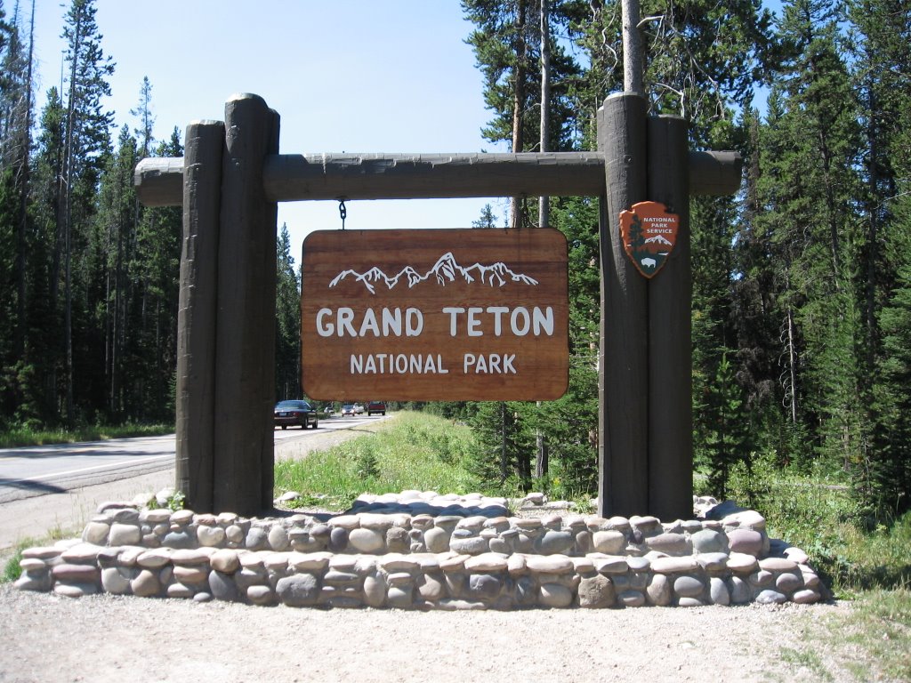
Grand Teton
 We got up and on the road by 7:10 AM so that we could be to the Jenny Lake Visitor Center by 7:45 AM in order to be assured of being four of the first 25 people to sign up for a ranger-led voyage across the lake and hike up to Inspiration Point. We were first in line—East Coast habits die hard!
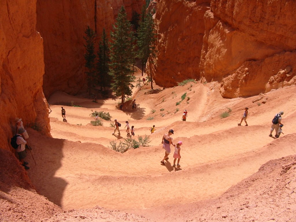
The 1-mile trip across the Jenny Lake aboard a pontoon boat and the 1-mile hike up to Inspiration Point was well worth the effort of getting up early. Even Emily, our late riser, said that this was the best hike we’ve done so far and that she was glad we woke her up to go on it (mighty high praise).
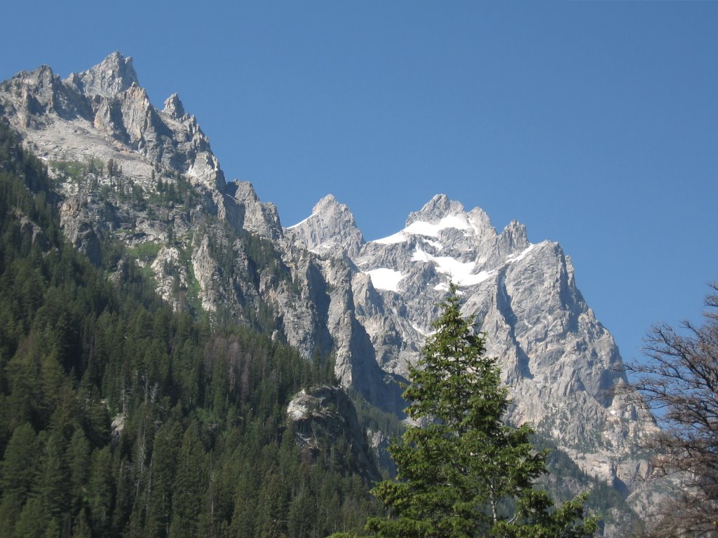
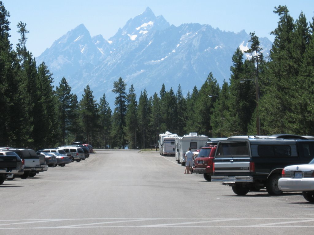
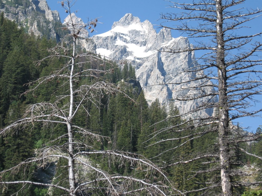
Our journey this morning took us closer to the Teton Range than we had been yesterday. Of course the closer we got the more imposing they were and the more impressed with them we became. These mountains rise very abruptly 6,000+ feet above the valley floor (Jackson Hole) to form a backdrop of grey granite that seems to take in sunlight and retransmit it with an intensity and beauty that defies conventional laws of nature. Elliot said he thought the Teton are the “Purple mountains” sung about in America the Beautiful.
 On our way up to inspiration point, we saw Hidden Falls, part of a fast-moving, high-volume stream (by Maryland standards), fed by snowmelt, that dumps into Jenny Lake. Because the stone of the Teton is so hard, very little water erosion takes place leaving the glacier rivers and steams, as well as Jenny Lake (256 feet deep) extremely clean and clear. The view from Inspiration point (420 feet above Jenny Lake) looking east over the lake and Jackson Hole was magnificent.
It was 12:30 PM when we completed the Jenny Lake adventure and we were quickly turning into hungry cave people. We took the suggestions of other hikers and tried Dornan’s for a pizza lunch—quite good. We then drove into Jackson. Incidentally, the town is named “Jackson,” and the valley north of town next to the Teton Range is “Jackson Hole.” The local airport is in Jackson Hole, which is the source of confusion for many tourists about what the town is named.
 Our first stop was the Jackson Visitor Center, an imposing, 2-story building with several impressive displays including a small herd of stuffed elk, and an outdoor deck which overlooks the National Elk Refuge just north of town. The visitor center is open to the public free of charge and is funded and operated without any public dollars. While there we attended a captivating lecture given by local resident and author, Ken Thomasma, who has written ten books, mostly historical fiction about Indian children. His one factual book, The Truth About Sacajawea, is considered the best and most comprehensive account of Sacagawea’s contributions to the Lewis and Clark expedition of 1804. He spoke convincingly about how the expedition would have been doomed many times over and the explorers would have died if it wasn’t for the heroics of the 15-year-old mother of a newborn, Sacagawea.
 Not surprisingly, Mr. Thomasma played an integral role in lobbying for Sacagawea’s likeness to appear on the gold U.S. dollar coins first minted in 2000. After the lecture, Frank bought two of Thomasma’s books and had them autographed by him. He gave Frank an uncirculated 2006 Sacagawea dollar and Elliot an audio tape of one of his books, read by Thomasma himself. Thomasma told us that since 2000 he has not used a paper dollar bill once, and is, no doubt, one of our nation’s most staunch advocates of doing away with paper singles and replacing them with coins (as Canada and the EU have). He claimed that doing so would save the United States $300 million per year.
We then drove into town and shopped for groceries at Albertsons. It was very nice to be in a real grocery store for the first time in a week.
Jackson stages a mock shootout, complete with shotguns, between some good guys and bad guys in the town plaza every day at 6 PM. It was the first gunfire Frank had heard since he last worked for the fire department more than a month ago. In fact, we realized yesterday that it had been many days since we heard a siren, jet airplane or the din of high-speed (Interstate) traffic. Ravens and diesel SUVs produced the only noise pollution we’ve encountered in a long time—nice.
We stuck around in Jackson and ate dinner at the Snake River Brewery and then drove back to our campsite and lit a fire and roasted s’mores. A nice day…
July 28, 2006
Grand Teton
 We got up and on the road by 7:10 AM so that we could be to the Jenny Lake Visitor Center by 7:45 AM in order to be assured of being four of the first 25 people to sign up for a ranger-led voyage across the lake and hike up to Inspiration Point. We were first in line—East Coast habits die hard!
The 1-mile trip across the Jenny Lake aboard a pontoon boat and the 1-mile hike up to Inspiration Point was well worth the effort of getting up early. Even Emily, our late riser, said that this was the best hike we’ve done so far and that she was glad we woke her up to go on it (mighty high praise).
Our journey this morning took us closer to the Teton Range than we had been yesterday. Of course the closer we got the more imposing they were and the more impressed with them we became. These mountains rise very abruptly 6,000+ feet above the valley floor (Jackson Hole) to form a backdrop of grey granite that seems to take in sunlight and retransmit it with an intensity and beauty that defies conventional laws of nature. Elliot said he thought the Teton are the “Purple mountains” sung about in America the Beautiful.
 On our way up to inspiration point, we saw Hidden Falls, part of a fast-moving, high-volume stream (by Maryland standards), fed by snowmelt, that dumps into Jenny Lake. Because the stone of the Teton is so hard, very little water erosion takes place leaving the glacier rivers and steams, as well as Jenny Lake (256 feet deep) extremely clean and clear. The view from Inspiration point (420 feet above Jenny Lake) looking east over the lake and Jackson Hole was magnificent.
It was 12:30 PM when we completed the Jenny Lake adventure and we were quickly turning into hungry cave people. We took the suggestions of other hikers and tried Dornan’s for a pizza lunch—quite good. We then drove into Jackson. Incidentally, the town is named “Jackson,” and the valley north of town next to the Teton Range is “Jackson Hole.” The local airport is in Jackson Hole, which is the source of confusion for many tourists about what the town is named.
 Our first stop was the Jackson Visitor Center, an imposing, 2-story building with several impressive displays including a small herd of stuffed elk, and an outdoor deck which overlooks the National Elk Refuge just north of town. The visitor center is open to the public free of charge and is funded and operated without any public dollars. While there we attended a captivating lecture given by local resident and author, Ken Thomasma, who has written ten books, mostly historical fiction about Indian children. His one factual book, The Truth About Sacajawea, is considered the best and most comprehensive account of Sacagawea’s contributions to the Lewis and Clark expedition of 1804. He spoke convincingly about how the expedition would have been doomed many times over and the explorers would have died if it wasn’t for the heroics of the 15-year-old mother of a newborn, Sacagawea.
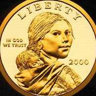 Not surprisingly, Mr. Thomasma played an integral role in lobbying for Sacagawea’s likeness to appear on the gold U.S. dollar coins first minted in 2000. After the lecture, Frank bought two of Thomasma’s books and had them autographed by him. He gave Frank an uncirculated 2006 Sacagawea dollar and Elliot an audio tape of one of his books, read by Thomasma himself. Thomasma told us that since 2000 he has not used a paper dollar bill once, and is, no doubt, one of our nation’s most staunch advocates of doing away with paper singles and replacing them with coins (as Canada and the EU have). He claimed that doing so would save the United States $300 million per year.
We then drove into town and shopped for groceries at Albertsons. It was very nice to be in a real grocery store for the first time in a week.
Jackson stages a mock shootout, complete with shotguns, between some good guys and bad guys in the town plaza every day at 6 PM. It was the first gunfire Frank had heard since he last worked for the fire department more than a month ago. In fact, we realized yesterday that it had been many days since we heard a siren, jet airplane or the din of high-speed (Interstate) traffic. Ravens and diesel SUVs produced the only noise pollution we’ve encountered in a long time—nice.
We stuck around in Jackson and ate dinner at the Snake River Brewery and then drove back to our campsite and lit a fire and roasted s’mores. A nice day…
posted by Hazzard Family | 15:36
|
0 comments
![]()

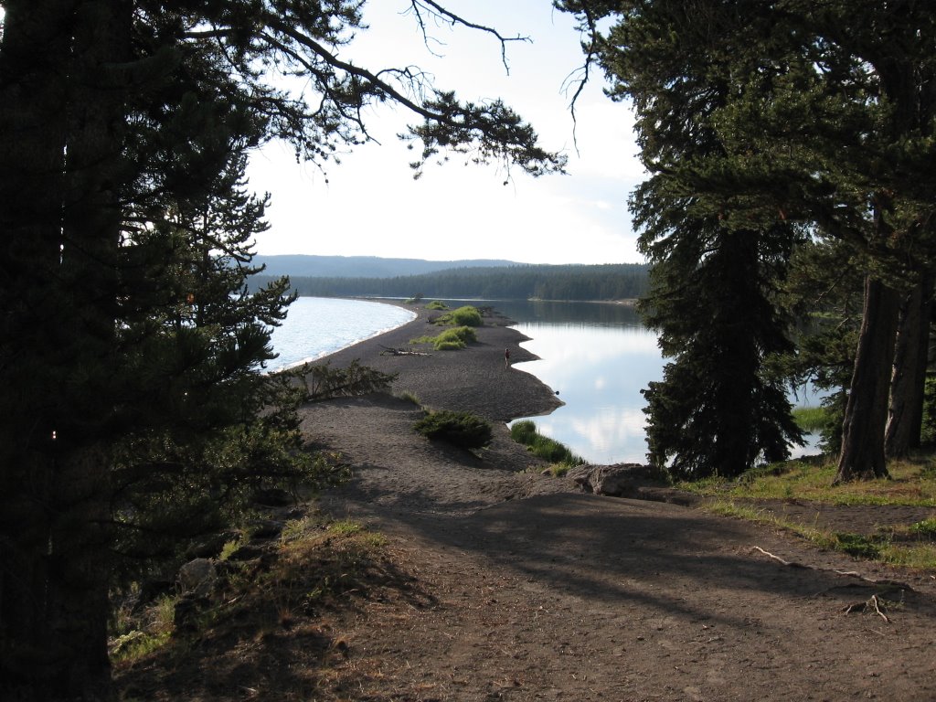


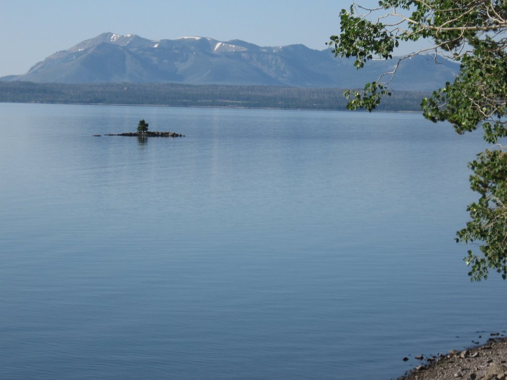

 From West Thumb, we took a hike on the Lake Overlook Trail (two miles round trip) through a section of the forest that had burned in 1988. After climbing 400 feet we came to a meadow where we could see for many miles in all directions, including the near and distant shores of Yellowstone Lake and the Grand Teton Mountains.


